Haryana’s Geography: A Deep Dive into Its Land, Climate, Water, and Environment
Haryana—a landlocked state in northern India—presents a fascinating mosaic of terrains: fertile plains, semi-arid deserts, ancient hills, and dynamic river systems. This 3,000-word exploration is designed to inform, engage, and convert, ideal for boosting reach and generating leads via rich content, vivid descriptions, and strategic structure.
1. Location, Area, & Administrative Snapshot
- Geographical Coordinates: Haryana stretches from approximately 27°39′ to 30°35′ N latitude and 74°28′ to 77°36′ E longitude, anchoring it firmly in Northern India.
- Total Area: The state covers around 44,212 km², about 1.4% of India’s landmass, ranking it 21st in size.
- Elevation Range: Most of Haryana lies between 200 m to 1,200 m above sea level.
- Borders:
- Punjab to the northwest
- Himachal Pradesh to the north–northeast
- Rajasthan to the west and south
- Uttar Pradesh (across Yamuna) to the east
- Delhi lies largely enveloped on three sides by Haryana
- The state also shares Chandigarh as its capital with Punjab.
2. Natural Topographical Divisions
According to official classifications, Haryana comprises five major physiographic zones:
- Bagar & Sandy Plains (230–350 m): Arid, dune-dominated tracts in the southwest (Sirsa, Hisar, Bhiwani), often with mobile dunes and sparse scrubland.
- Alluvial Plain (Ghaggar–Yamuna Plain) (below 300 m): The state’s agricultural backbone, composed of older (Bangar) and newer (Khadar, Nali, Bet) alluvium layers. This region slopes gradually from northeast to southwest and includes distinctive landscape features like kankar nodules and saucer-like troughs.
- Aravali Outliers (300–600 m): Fragmented, ancient ridges, particularly in southern districts like Nuh and Rewari, shaping local ecology and topography.
- Shivalik Hills (over 400 m): A narrow band of foothills in the northeast—erosion-prone and geologically young—forming part of the Himalayan system.
- Piedmont Zone (300–400 m): The transition belt featuring seasonal streams and unstable soils between the Shivaliks and plains.
Other landscape notes:
- The state’s elevation generally ranges from flat plains (~210–270 ft) to rolling uplands and isolated hills (up to 1,467 m).
3. Highest Peaks & Notable Hills
- Karoh Peak, at 1,467 m, is Haryana’s highest point, located in the Sivalik Hills near Morni.
- Morni Hills (approx. 1,267 m) are scenic highlands near Panchkula, drawing tourists with their relatively cooler climate.
- Dhosi Hill (740 m), nestled at the Haryana–Rajasthan border, is a site of mythological and cultural importance, linked to sage Chyavana.
- Other lesser elevations include Tosham (~240 m) and Madhogarh (~214 m), serving as modest yet geologically interesting outcrops.
4. Soils & Agricultural Landscape
- Alluvial Soils: Vast, deep, and fertile across the plains, ideal for intensive cropping.
- Sandy & Arid Soils: Predominant in the Bagar region; characterized by shifting dunes and low soil moisture.
- Red & Gravelly Soils: Appear in the southern uplands and Aravali fringes.
- Terrain-specific soil types:
- Bangar (older alluvium, often with kankar layers)
- Khadar/Nali/Bet (new alluvial deposits in flood zones, highly fertile)
- Soil Challenges: Salinity, nutrient imbalance, and erosion in certain areas. The presence of CSSRI underscores the significance of soil and salinity research in Haryana.
5. Rivers, Canals, & Water Bodies
Major Rivers
- Yamuna: Haryana’s only perennial river; defines the eastern boundary and is vital for irrigation.
- Ghaggar–Hakra: Seasonal river with a historical legacy, stretching across northern Haryana into Rajasthan.
- Markanda, Sarasvati (palaeochannel), Tangri, Dohan, Krishnavati, and Sahibi: Contribute seasonal flows and agricultural recharge.
Water Infrastructure
- Canals: Western Yamuna Canal, Sutlej–Yamuna Link enhance irrigation reach.
- Dams & Barrages: Kaushalya Dam, Ottu Barrage, Tajewala, Hathnikund—key for flood control and water storage.
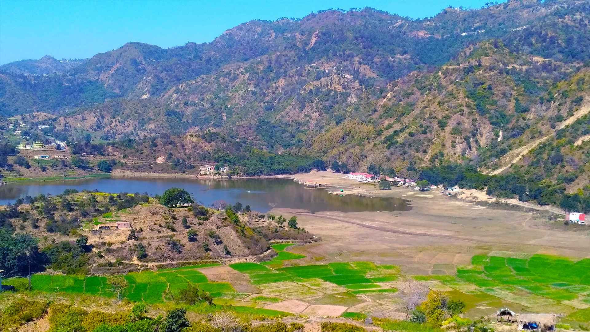
Lakes & Wetlands
Prominent water bodies include:
- Badkal Lake, Surajkund, Blue Bird Lake, Damdama Lake, Karna Lake, Tilyar Lake, Brahma Sarovar, Sannihit Sarovar, and various small wetlands—ecological and cultural hotspots.
Water-logging & Flooding
Monsoonal excess can lead to agricultural and urban waterlog. For example, recent rains triggered dewatering operations and crop damage assessments in Yamuna, Ghaggar, Tangri, and Markanda catchments.
6. Climate & Meteorological Patterns
- Climatic Type: Predominantly arid to semi-arid; slightly more humid in the northeast near the Shivaliks.
- Temperature Ranges:
- Summer highs: Up to 45 °C or approx. 110°F.
- Winter lows: Near or below 0 °C.
- Rainfall Patterns:
- Average: ~450 mm annually, though southwestern zones may get under 350 mm; northern hills may exceed 1,100 mm.
- Distribution: ~70–80% during monsoon (July–September); rest arrives via western disturbances (Dec–Feb).
- Weather Extremes: Dust storms, heatwaves in summers; fog and cold snaps in winters. Flash floods also occur in low-lying floodplain areas.
7. Vegetation, Wildlife & Ecology
Forest & Vegetative Cover
- Forest Cover: Only 3.9%, well below national and state targets. Additional 3.6% is under tree cover, totaling around 7.14% green area.
- Forested Regions: Concentrated in the Shivalik and Aravali belts.
- Special Ecosites: Mangar Bani, a sacred grove in Aravallis, notable for biodiversity and pre-historic archaeology.
Flora Highlights
- Common species: Shisham, Babool (Acacia), Eucalyptus, Kikar; wild shrubbery in arid zones.
Fauna Diversity
- Mammals: Blackbuck (state animal), nilgai, panther, wild boar, jackal, mongoose, fox—especially in hilly and scrub zones.
- Avifauna: Over 300 bird species, including black francolin (state bird), sunbirds, kingfishers, buntings, Teals, and ducks.
- Reptiles: Snakes (non-venomous and venomous), lizards, frogs, tortoises.
Protected Areas
Several sanctuaries and national parks, such as Sultanpur, safeguard this diverse wildlife under Haryana Forest Department’s oversight.
8. Agriculture, Economy & Land Use
- Farmland: Around 80% of Haryana is cultivated land— a testament to its agricultural prominence.
- Major Crops: Wheat, rice (notably Basmati), sugarcane, mustard, cotton, pulses, maize—thanks to fertile soils and irrigation networks.
- Contribution: Key producer of India’s foodgrain reserves, especially wheat and rice. Haryana has played a crucial part in India’s Green Revolution.
- Industry: Alongside agriculture, regions like Gurugram, Faridabad, Panipat, Manesar are economic powerhouses—fueled by manufacturing, IT, auto, and logistics infrastructure.
9. Environment, Conservation & Emerging Challenges
Groundwater & Irrigation
- Widespread groundwater depletion calls for interventions like drip/sprinkler systems and recharge programs.
Aravali Conservation Controversy
- Haryana’s move to define Aravali zones based on relative height (e.g., 100 m above surroundings) risks leaving vital ecological regions—like Mangar Bani—unprotected.
Forest Depletion
- Forest cover loss (~80 km² between 2014–17) continues due to urban sprawl and land use changes.
Flood & Waterlogging
- Recent rains triggered emergency responses to manage waterlogging and crop damage across several districts.
Pollution & Urban Stress
- Suburban zones of Delhi-NCR face air and water pollution challenges, increasing ecological pressure.
10. Transport & Regional Connectivity
- Road Network: 39,000+ km, enhancing internal connectivity with neighbors like Delhi, Punjab, and Rajasthan.
- Railways: Well-established, linking key cities to the national rail network.
- Airports: Indira Gandhi International Airport, Delhi; Hisar Airport.
Conclusion
Haryana’s geography—its rivers, plains, hill ranges, and arid regions—shapes its environmental identity, economy, and the livelihoods of its citizens. Rich in agricultural output and natural beauty, the state faces critical environmental challenges. Addressing water scarcity, forest depletion, and urbanization must become top priorities to sustain Haryana’s natural wealth in the long term.